
Garmin introduces the GPSMAP 9000 series, the largest chartplotters with 4K resolution
by Garmin 12 Sep 2023 17:32 BST
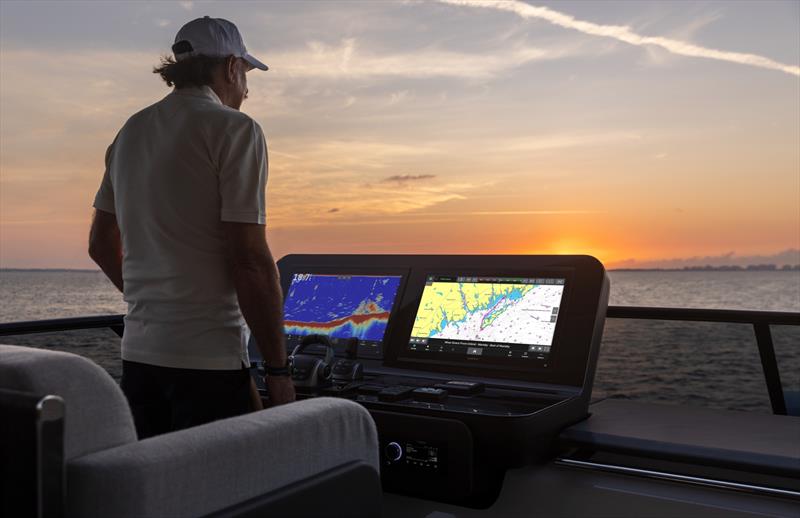
GPSMAP® 9000 chartplotter series © Garmin
Garmin (NYSE: GRMN), the world's most innovative and recognised marine electronics manufacturer, today unveiled its flagship GPSMAP® 9000 chartplotter series designed for captains who demand the best.
Available with 19", 22", 24" or 27" touchscreen displays, these all-in-one chartplotters offer stunning 4K resolution with edge-to-edge clarity, powered by a processor that's seven-times faster than previous generations. Thanks to the new Garmin BlueNet™ gigabit network, these premium multi-function displays (MFDs) provide comprehensive connectivity throughout the vessel with faster networking speeds than ever before.
"For decades, mariners have been relying on Garmin's GPSMAPs to help them navigate waters all over the world. Building on that success, we're thrilled to unveil the 9000 series with bigger, best-in-class displays, lightning-fast processing speeds and the ultimate connected boating experience on the new Garmin BlueNet network." -Dan Bartel, Garmin Vice President of Global Consumer Sales
Premium design and processing power
The 4K resolution GPSMAP 9000 series delivers a seamless and luxurious modern look with a maximised glass design. Available in 19", 22", 24" or 27" displays, the industry's largest integrated touchscreen chartplotter size, each MFD can be flat or flush mounted to create a stunning glass helm. For superior clarity and sunlight readability, these in-plane switching (IPS) touchscreen displays provide consistent, accurate colors that can be seen from all viewing angles, even with polarized sunglasses. And for the first time, anglers can see fish and sonar targets in stunning 4K high definition, too, by adding a Garmin GSD™ sonar module, Panoptix™ transducer or LiveScope™ sonar (transducers sold separately).
Offering seven times the processing power of the previous generations, the GPSMAP 9000 is quick and responsive and delivers Garmin's fastest map drawing and Auto Guidance+™ routing1. This premium processing power significantly benefits all onboard sensors like sonar, radar, cameras, video and digital switching, and enhances the user experience across the entire network.
Enhanced networking and connectivity
Utilising Garmin's new BlueNet gigabit network, mariners can link the GPSMAP 9000 series with multiple chartplotters, cameras, radars, sonars and more at 10 times faster networking speeds. Powered by BlueNet, the GPSMAP 9000 series offers enhanced multimedia streaming and seamless video integration, so onboard entertainment has never looked better. Users can even play and hear the same video throughout multiple screens and speakers on the network thanks to HDCP (high-bandwidth digital content protection) distribution. The 9000 series can also connect to compatible existing Garmin marine systems, including other GPSMAP chartplotters2, radars, autopilots, sensors and more via NMEA® 2000 and NMEA® 0183 networks, and built-in Wi-Fi® enables reliable wireless software updates via the ActiveCaptain® app with a compatible smartphone or tablet.
Innovative integration
As the command center of the boat, the GPSMAP 9000 series offers easy and expansive integration capabilities with onboard systems, including:
- Engine monitoring lets captains keep tabs on engine data performance like rpm, speed, fuel flow, temperature, exceedance warnings and more.
- OneHelm™ integrated digital switching offers full support for the EmpirBus™ system and other third-party monitoring, control and automation solutions.
- Listen to music, enjoy a movie and get audio alerts with Fusion® audio and entertainment integration.
- Control and see footage directly on the chartplotter with extensive camera support; even get a live 360-degree bird's-eye view of the vessel during low-speed maneuvers such as docking in a tight spot with Garmin's Surround View Camera System (sold separately).
- Connect a GPSMAP 9000 chartplotter with a compatible Garmin smartwatch for remote control of key MFD features including chart zoom, autopilot control and more, directly from the wrist.
- Use voice commands to control the chartplotter through a compatible headset (not included).
- OEMs can customize the homepage layout and splash screen for a unique, branded look.
The GPSMAP 9000 series supports Garmin Navionics+™ charts that includes Auto Guidance+ technology for faster route calculations and improved routing detail, along with a one-year subscription to daily updates for the most up-to-date content available. Upgrade to the Garmin Navionics Vision+™ premium mapping to add relief shading, sonar imagery, high-resolution satellite imagery, aerial photography and more.
Expected to be available next month, the GPSMAP 9000 series has retail pricing starting at £9049.99. A GPS 24xd position receiver and antenna with multi-band GPS is included with each MFD, which delivers precise location information and heading accuracy, even at slow speeds. To learn more, visit garmin.com/marine.
Engineered on the inside for life on the outside, Garmin products have revolutionised life for anglers, sailors, mariners, and boat enthusiasts everywhere. Committed to developing the most innovative, highest quality, and easiest to use marine electronics the industry has ever known, Garmin believes every day is an opportunity to innovate and a chance to beat yesterday. Other Garmin marine brands include Navionics®. For more information, visit garmin.com/blog.
1 Auto Guidance+ is for planning purposes only and does not replace safe navigation operations.
2 BlueNet Gateway required.