Edition


-(1)-202408140552.gif)


Boats for sale
| Laser 140101 Tynemouth |
 |
| Laser 28 - Excellent example of this great design Hamble le rice |
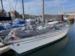 |
| Rossiter Pintail Mortagne sur Gironde, near Bordeaux |
 |
List classes of boat for sale |


Garmin GPS 72H |
Post Reply 
|
Page <12 |
| Author |
 Printable Version Printable Version Delicious Delicious Digg Digg Facebook Facebook Furl Furl Google Google MySpace MySpace Newsvine Newsvine reddit reddit StumbleUpon Translate StumbleUpon Translate Twitter Twitter Windows Live Windows Live Yahoo Bookmarks Yahoo Bookmarks Topic Search Topic Search  Topic Options Topic Options
|
Brass 
Really should get out more 
Joined: 24 Mar 08 Location: Australia Online Status: Offline Posts: 1151 |
 Post Options Post Options
 Quote Reply Quote Reply
 Topic: Garmin GPS 72H Topic: Garmin GPS 72HPosted: 16 Jul 14 at 1:49am |
|
I'm not sure that it's the keystroke sequences you need. Mark laying with a GPS doesn't need any very sophisticated use of the GPS. You can get by with just Pinging a position, setting GO TO and display of bearing and distance to a waypoint. Using Project Location is a bonus.
You can't expect the Garmin manuals to tell you how to use a GPS to lay marks, that's what your RYA RO or mark layers course will do. The ISAF Race Management Manual (RMM) contains all you really need to know. Marks can be laid by GPS using the following methods
I prefer the common Reference Point method because it's simplest (very simple for 60 degree triangles and 70 degree trapezoids). For what it's worth, here's what I do (a real RO or IML may come along and put me right).
Edited by Brass - 16 Jul 14 at 6:14am |
|
 |
|
|
winging it
Really should get out more

Joined: 22 Mar 07 Online Status: Offline Posts: 3958 |
Post Options
Quote Reply
Posted: 15 Jul 14 at 9:25pm |
|
We did a mark laying course using these not very long ago, I got a handout with it which could be scanned and forwarded. Pm me your email address?
|
|
|
the same, but different...
|
|
|
|
|
Medway Maniac
Really should get out more
Joined: 13 May 05 Location: United Kingdom Online Status: Offline Posts: 2788 |
Post Options
Quote Reply
Posted: 15 Jul 14 at 10:38am |
Sounds like the usual story with Garmin GPS. I have usually found a website where someone describes the functions and tricks, at least for the cycling products, but the manuals are hopeless. Otherwise, it is just the use of trial and error and intelligence, I'm afraid, unless you're lucky enough to meet someone with the same unit. |
|
|
|
|
Buzz
Posting king 
Joined: 14 Jun 04 Online Status: Offline Posts: 101 |
Post Options
Quote Reply
Posted: 15 Jul 14 at 10:28am |
|
My original post was prompted by the lack of detail in the Garmnin getting started manual and the owners manual both of which which I downloaded when I got the GPS. I was hoping that someone might know for have a really detaied manual or book. I have also looked through numerous YouTube videos but I was unable to find what I wanted.
|
|
|
|
|
Brass
Really should get out more
Joined: 24 Mar 08 Location: Australia Online Status: Offline Posts: 1151 |
Post Options
Quote Reply
Posted: 15 Jul 14 at 4:02am |
|
https://support.garmin.com/support/manuals/searchManuals.faces
See, that wasn't so hard to Google was it?
|
|
|
|
|
Buzz
Posting king
Joined: 14 Jun 04 Online Status: Offline Posts: 101 |
Post Options
Quote Reply
Posted: 14 Jul 14 at 4:42pm |
|
Could anyone recommend where I could find a detailed set of instructions on how to use the above GPS please. The manual that comes with it is useless. I want to use it for laying marks.
|
|
|
|

|
Post Reply
|
Page <12 |
| Forum Jump | Forum Permissions You cannot post new topics in this forum You cannot reply to topics in this forum You cannot delete your posts in this forum You cannot edit your posts in this forum You cannot create polls in this forum You cannot vote in polls in this forum |
Bulletin Board Software by Web Wiz Forums® version 9.665y
Copyright ©2001-2010 Web Wiz
Change your personal settings, or read our privacy policy
Copyright ©2001-2010 Web Wiz
Change your personal settings, or read our privacy policy