


-(1)-202408140552.gif)


| Rossiter Pintail Mortagne sur Gironde, near Bordeaux |
 |
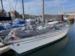
| Laser 28 - Excellent example of this great design Hamble le rice |
 |
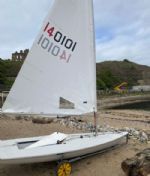
| Laser 140101 Tynemouth |
 |
List classes of boat for sale |


Velocitek S10 |
Post Reply 
|
Page <1234> |
| Author |
 Printable Version Printable Version Delicious Delicious Digg Digg Facebook Facebook Furl Furl Google Google MySpace MySpace Newsvine Newsvine reddit reddit StumbleUpon Translate StumbleUpon Translate Twitter Twitter Windows Live Windows Live Yahoo Bookmarks Yahoo Bookmarks Topic Search Topic Search  Topic Options Topic Options
|
|
Guest 
Newbie 
Joined: 21 May 04 Location: United Kingdom Online Status: Offline Posts: 0 |
 Post Options Post Options
 Quote Reply Quote Reply
 Topic: Velocitek S10 Topic: Velocitek S10Posted: 29 May 07 at 4:10pm |
|
|
Here is a replay of the recent Msuto Skiff open at Stokes Bay. 3 races tracked of 2 boats (mine & Sten). Quite intersting to see just how shifty it was http://www.mustoskiff.com/replays/2007/stokes-bay/gpsar.html
|
||
 |
||
|
Wrighty
Posting king 

Joined: 21 Mar 07 Location: United Kingdom Online Status: Offline Posts: 192 |
Post Options
Quote Reply
Posted: 25 May 07 at 11:14pm |
|
|
I use the foretrex 201 with the inbuilt battery, I takes about 20min to get the mean wind direction setting right. I set the the waypoint 60 miles away. I have to change this about 3 times in a 4 hour sail as the wind moves around. The function Turn is very good in evaluating my angle from direct downwind,sailind dead downwind should read turn 0. Very pleased with it. it got smacked by the boom and survived. If you want to put it on the mast any gps with a large screen will do. I use a garmin GPSmap 76CSx waterproof and floats, in a waterproof bag just in case.Very large display taped to mast. I find that the vmg drops when heading up before rising as my speed increases, also when slowly going lower the vmg rises before it drops when the speed drops. very hard to evaluate if the wind is not constant. I find that pointing high and footing off in the rs600 gives the same vmg. but in large gusts it pays to foot. ? After a month or two i think it will not be an advantage to have vmg but i still need a good stopwatch and compass, Have I got to pay £45 for a yellow stopwatch and drill holes in my mast for a compass when iv got the lot in my foretrex ? At the moment I only use record and stopwatch for racing as my yellow stopwatch came out of the case last week Are we going to police these gps devices as it could be classed as cheating. I know the musto have allowed this for some events but are other classes going to let it go ? After thinking about it the foretrak will always be banned as you could view the track down the startline for midline sag Edited by Wrighty |
||
|
Wrighty
|
||
|
||
|
boatshed
Far too distracted from work 
Joined: 12 Apr 05 Online Status: Offline Posts: 457 |
Post Options
Quote Reply
Posted: 25 May 07 at 1:17pm |
|
|
Regarding the Velocitek. How easy is it to eye up the true wind direction when setting the upwind reference point ? Stikes me that one could be quite a lot out. Is it better to sail more than the suggested 75 m to minimise the error ? If the race course is a bit "off", ie. not true upwind downwind, is it better to use the windward mark as the upwind ref point ?
|
||
|
Steve
|
||
|
||
|
I luv Wight
Really should get out more 
Joined: 28 Jan 05 Location: United Kingdom Online Status: Offline Posts: 628 |
Post Options
Quote Reply
Posted: 28 Feb 07 at 11:08pm |
|
|
Velocitek sponsor the UK Cherub Nationals for 2007
S10 as prize(s) + lots of beer! see http://www.uk-cherub.org |
||
|
||
|
I luv Wight
Really should get out more
Joined: 28 Jan 05 Location: United Kingdom Online Status: Offline Posts: 628 |
Post Options
Quote Reply
Posted: 13 Feb 07 at 6:30pm |
|
|
Yes you enter an upwind and down wind point at least 75 yds apart ( ie you press the buttons, sail up wind for 75 yds, then press the buttons again )
This gives a heading that the vmg references to. A 10% wind shift makes little difference ( sin 10° is not far off sin 0° ) Or you can enter the actual mark locations to give a vmg to the mark (heading). Set up the downwind position at the start, and the upwind position at the top mark. Rohan Veal does this in foily moths - the first leg is more about in-fleet tactics than speed, so it's less important on the first beat. The magnitude of the vmg may be lower than the real vmg to the wind, but by maximising the displayed vmg - that's the fastest way to the mark. It doesn't tell you when to tack or gybe for the mark, so you will still need some skill! follow the sig link for pricing |
||
|
||
|
k_kirk
Posting king
Joined: 09 May 06 Location: Japan Online Status: Offline Posts: 172 |
Post Options
Quote Reply
Posted: 13 Feb 07 at 3:33pm |
|
You have two external buttons. One for each end of the windward / leeward course. When you reach each mark you just touch the button. Or you can even do the setting on land. All it does is to store the compass heading between the two points you touch the buttons and then compute VMG using trigonometry. This is explained quite nicely in the user manual pdf which is on their web site. Hope this helps. |
||
|
||
|
k_kirk
Posting king
Joined: 09 May 06 Location: Japan Online Status: Offline Posts: 172 |
Post Options
Quote Reply
Posted: 13 Feb 07 at 3:30pm |
|
Very interesting. Can you share which phone and software combo you use? I have a HP6965 PocketPC phone with integral GPS and have been wondering how I can make use of it on water. Are you using a PocketPC phone by any chance? |
||
|
||
|
Fin.
Posting king
Joined: 12 Feb 07 Location: Ireland Online Status: Offline Posts: 128 |
Post Options
Quote Reply
Posted: 13 Feb 07 at 1:54pm |
|
|
I had a look at their website - can I ask how much they are. (I couldn't find price-information),. Certainly sound very interesting - was personally about to start looking into buying an etrex. thanks Fin |
||
|
||
|
Guest
Newbie
Joined: 21 May 04 Location: United Kingdom Online Status: Offline Posts: 0 |
Post Options
Quote Reply
Posted: 13 Feb 07 at 1:02pm |
|
I believe you enter a waypoint a long way upwind and downwind and it measures your speed towards that point ... |
||
|
||
|
bustinben
Far too distracted from work
Joined: 15 Oct 06 Online Status: Offline Posts: 288 |
Post Options
Quote Reply
Posted: 13 Feb 07 at 12:11pm |
|
|
I've got a GPS in my phone that I use to record NMEA logs when I'm racing. Then I've got a converter that plots the track into google earth - you can really see how well you were playing the shifts upwind! |
||
|
||


 , in carsington somewhere.
|
Post Reply
|
Page <1234> |
| Forum Jump | Forum Permissions You cannot post new topics in this forum You cannot reply to topics in this forum You cannot delete your posts in this forum You cannot edit your posts in this forum You cannot create polls in this forum You cannot vote in polls in this forum |
Copyright ©2001-2010 Web Wiz
Change your personal settings, or read our privacy policy