


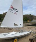
| Laser 140101 Tynemouth |
 |
| Rossiter Pintail Mortagne sur Gironde, near Bordeaux |
 |
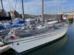
| Laser 28 - Excellent example of this great design Hamble le rice |
 |
List classes of boat for sale |


magnetic anomalies |
Post Reply 
|
Page <123> |
| Author |
 Printable Version Printable Version Delicious Delicious Digg Digg Facebook Facebook Furl Furl Google Google MySpace MySpace Newsvine Newsvine reddit reddit StumbleUpon Translate StumbleUpon Translate Twitter Twitter Windows Live Windows Live Yahoo Bookmarks Yahoo Bookmarks Topic Search Topic Search  Topic Options Topic Options
|
|
Stefan Lloyd 
Really should get out more 
Joined: 03 Aug 04 Online Status: Offline Posts: 1599 |
 Post Options Post Options
 Quote Reply Quote Reply
 Topic: magnetic anomalies Topic: magnetic anomaliesPosted: 25 Apr 06 at 6:55am |
|
|
Was? Has it changed lately? |
||
 |
||
|
Blobby
Really should get out more

Joined: 07 May 04 Location: Australia Online Status: Offline Posts: 779 |
Post Options
Quote Reply
Posted: 25 Apr 06 at 7:24am |
|
|
Well bits do keep trying to fall into the sea every now and then... |
||
|
One step forwards, 2 steps back...
|
||
|
||
|
tack'ho
Really should get out more

Joined: 08 Feb 06 Location: United Kingdom Online Status: Offline Posts: 1100 |
Post Options
Quote Reply
Posted: 25 Apr 06 at 8:14am |
|
|
The answer is obvious, aliens indeed! If you look on your chart you will see lots of areas annotated cables or disused cables. Now as these cables are used to secure the IOW to the mainland and prevent it drifting toward france, nothing deserves that fate and I say to hell with the cost, they need to be very large and made of paticularly densely wound steel. This steel with affect any compass nearby QED. |
||
|
I might be sailing it, but it's still sh**e!
|
||
|
||
|
Black no sugar
Really should get out more

Joined: 04 Dec 04 Location: Somewhere between Brighton and Lancing Online Status: Offline Posts: 3941 |
Post Options
Quote Reply
Posted: 25 Apr 06 at 8:40am |
|
True that France doesn't deserve the IoW coming crashing into its shores (especially because it would come straight into my Mum and Dad's front garden!).
PS. If you read this, MarkR, I'm only kidding! The Contender open in Brading Haven was wonderful last year and I'll be there again this year, promise!! |
||
|
||
|
Chief Wiggam
Newbie 

Joined: 12 Apr 06 Location: United Kingdom Online Status: Offline Posts: 13 |
Post Options
Quote Reply
Posted: 25 Apr 06 at 9:14am |
|
|
Perhaps the Isle of Wight doesn't need a bunch of elderly singlehanders coming over here! Re the compass variations the answer could be due to geological anomalies in the sedimentary Wessex basin where differing densities of strata are to be found - alternatively it could be all the metal fittings that fall off all these Contenders.......thank God the ferries run both ways There are a considerable number of cables around the Gurnard area including a new water pipe - I suspect that this is probably the answer although |
||
|
THE ISLE OF WIGHT - "2 MILLION SEAGULLS CAN'T BE WRONG"
WHITECLIFF BAY - CHAV FREE BOATING FOR THE LOCALS |
||
|
||
|
Chief Wiggam
Newbie
Joined: 12 Apr 06 Location: United Kingdom Online Status: Offline Posts: 13 |
Post Options
Quote Reply
Posted: 25 Apr 06 at 9:23am |
|
|
See - I knew I was right!!!!!!!!!!!!!! A geological map covering 7000 square nautical miles of solid rock floor of a section of the Eastern English Channel is presented. This map is based on the results of a systematic sampling and continuous reflection profiling (Sparkers) grid. A total of 279 core stations have been manned and 3500 nautical miles of sparkers, magnetometer and echo sounding traverses were carried out. Edited by Chief Wiggam |
||
|
THE ISLE OF WIGHT - "2 MILLION SEAGULLS CAN'T BE WRONG"
WHITECLIFF BAY - CHAV FREE BOATING FOR THE LOCALS |
||
|
||
|
Black no sugar
Really should get out more
Joined: 04 Dec 04 Location: Somewhere between Brighton and Lancing Online Status: Offline Posts: 3941 |
Post Options
Quote Reply
Posted: 25 Apr 06 at 9:37am |
|
|
As for the bunch of elderly singlehanders, you're probably right, Chief Wiggam... There are more than enough on the IoW as it is! Still, take cover on the 24-25th June in Bembridge cos we'll be back, teeehee! |
||
|
||
|
tack'ho
Really should get out more
Joined: 08 Feb 06 Location: United Kingdom Online Status: Offline Posts: 1100 |
Post Options
Quote Reply
Posted: 25 Apr 06 at 9:37am |
|
Burn the sheep Blockade Cowes and go on stike till the pension and employment rights of Ethel the B&B hostess were comparable to those enjoyed by Mr. Hilton? |
||
|
I might be sailing it, but it's still sh**e!
|
||
|
||
|
Blobby
Really should get out more
Joined: 07 May 04 Location: Australia Online Status: Offline Posts: 779 |
Post Options
Quote Reply
Posted: 25 Apr 06 at 10:44am |
|
Hmmm. I am going to have to get the missus in on this one - what with her being an ex-geologist and all... who is hiding in the basement anyway? must be those aliens. (or the welsh - they like holes in the ground too - so maybe it is welsh aliens - or the welsh are aliens...) |
||
|
One step forwards, 2 steps back...
|
||
|
||
|
mike ellis
Really should get out more

Joined: 30 Dec 05 Location: United Kingdom Online Status: Offline Posts: 2339 |
Post Options
Quote Reply
Posted: 03 May 06 at 7:49pm |
|
can i have that in english please? i knew it wasnt the aliens but could the welsh have put all these strata here |
||
|
600 732, will call it Sticks and Stones when i get round to it.
Also International 14, 1318 |
||
|
||


|
Post Reply
|
Page <123> |
| Forum Jump | Forum Permissions You cannot post new topics in this forum You cannot reply to topics in this forum You cannot delete your posts in this forum You cannot edit your posts in this forum You cannot create polls in this forum You cannot vote in polls in this forum |
Copyright ©2001-2010 Web Wiz
Change your personal settings, or read our privacy policy